andes
If you prefer the old format of this gallery, change the "/images/" in the url for this page to "/topics/". For example:
NEW: http://photos.mongabay.com/staff/images/aceh1.html => http://photos.mongabay.com/staff/topics/aceh1.html
Staff photo index
Last update: 2017-07-27
-
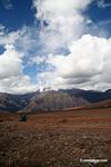
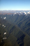
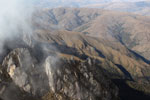
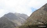
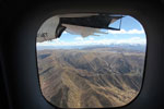
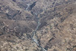
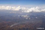
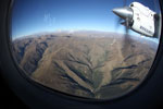
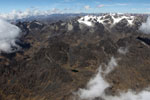
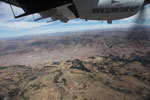
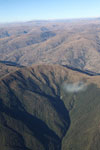
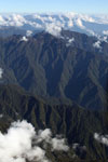 Highest reaches of the Amazon rainforest Highest reaches of the Amazon rainforest
(Peru)
-
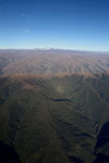
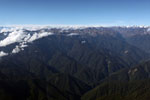
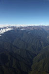
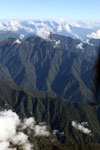
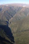
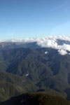
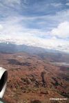
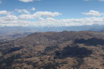
 Upper Amazon forest and the Andes Upper Amazon forest and the Andes
(Peru)
-
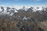
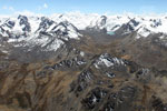
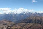
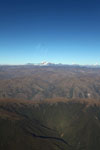
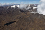
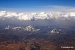
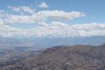
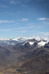
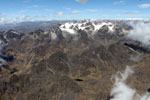
 Amazon rainforest and Andean glaciers and peaks Amazon rainforest and Andean glaciers and peaks
(Peru)
-
 Willoq baby Willoq baby
(Peru)
-
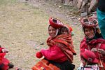
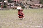
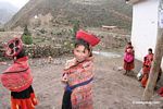 Young girl in Willoq community wearing traditional clothing Young girl in Willoq community wearing traditional clothing
(Peru)
-
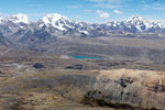
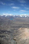
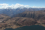
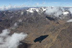
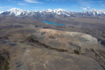 Andean peaks and a turquoise lake Andean peaks and a turquoise lake
(Peru)
-
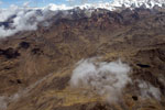
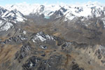
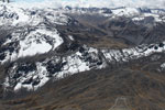
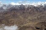
 Andean landscape with glaciers and snow-capped peak Andean landscape with glaciers and snow-capped peak
(Peru)
-
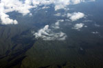
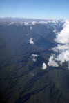
 Upper Amazon cloud forest and the Andes Upper Amazon cloud forest and the Andes
(Peru)
-
 Uppermost reaches of the Amazon basin watershed Uppermost reaches of the Amazon basin watershed
(Peru)
-
![Amazon cloud forest and the Andes [peru_aerial_0054]](http://s3.amazonaws.com/mongabay/peru/150/peru_aerial_0054.jpg) Amazon cloud forest and the Andes [peru_aerial_0054] Amazon cloud forest and the Andes [peru_aerial_0054]
(Peru)
-
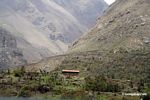
![Remote house atop a mountain peak in the Andes [peru_aerial_1725]](http://s3.amazonaws.com/mongabay/peru/150/peru_aerial_1725.jpg) Remote house atop a mountain peak in the Andes [peru_aerial_1725] Remote house atop a mountain peak in the Andes [peru_aerial_1725]
(Peru)
-
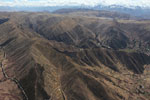
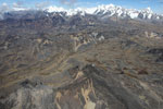
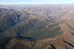
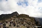
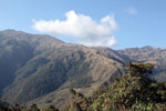
 Rugged Andes Rugged Andes
(Peru)
-
 Andean peaks and a turquoise lake Andean peaks and a turquoise lake
(Peru)
-
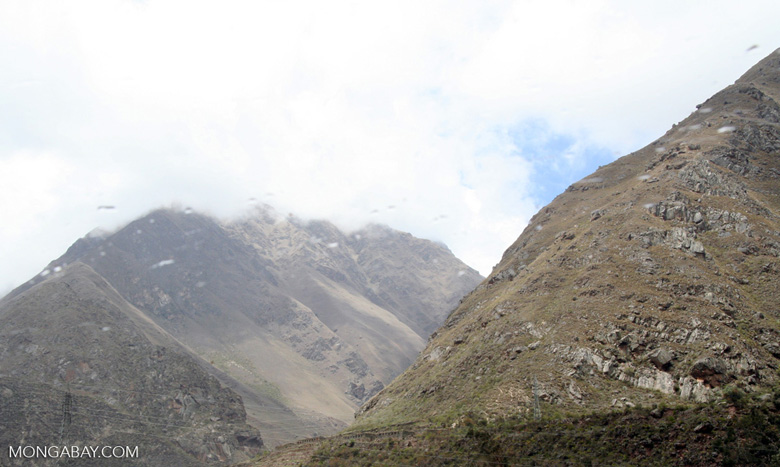
![Urubamba Valley [cuzco-Urubamba_1018_0729]](http://www.mongabay.com/thumbnails/peru/cuzco/Urubamba_1018_0729.JPG) Urubamba Valley [cuzco-Urubamba_1018_0729] Urubamba Valley [cuzco-Urubamba_1018_0729]
(Peru)
-
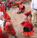
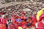
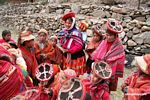 Mothers and kids in the Willoq community Mothers and kids in the Willoq community
(Peru)
-
 Amazon cloud forest and the Andes Amazon cloud forest and the Andes
(Peru)
-
![Urubamba Valley [cuzco-Urubamba_1018_0620]](http://www.mongabay.com/thumbnails/peru/cuzco/Urubamba_1018_0620.JPG) Urubamba Valley [cuzco-Urubamba_1018_0620] Urubamba Valley [cuzco-Urubamba_1018_0620]
(Peru)
-
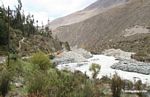
 Glacier melt in the Andes Glacier melt in the Andes
(Peru)
-
 Glacial peaks in the Andes Glacial peaks in the Andes
(Peru)
-
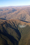
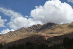
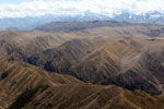
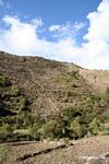
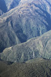
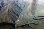
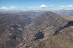
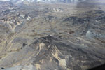
 Andean terrain Andean terrain
(Peru)
-
![Urubamba Valley [cuzco-Urubamba_1018_0644]](http://www.mongabay.com/thumbnails/peru/cuzco/Urubamba_1018_0644.JPG) Urubamba Valley [cuzco-Urubamba_1018_0644] Urubamba Valley [cuzco-Urubamba_1018_0644]
(Peru)
-
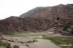
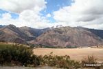
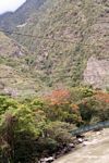
 Urubamba Valley Urubamba Valley
(Peru)
-
 Smiling mothers with babies on their backs Smiling mothers with babies on their backs
(Peru)
-
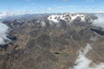
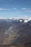
 Snow-capped peaks in the Andes Snow-capped peaks in the Andes
(Peru)
-
![Amazon cloud forest and the Andes [peru_aerial_0048]](http://s3.amazonaws.com/mongabay/peru/150/peru_aerial_0048.jpg) Amazon cloud forest and the Andes [peru_aerial_0048] Amazon cloud forest and the Andes [peru_aerial_0048]
(Peru)
-
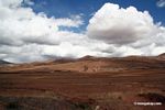
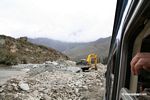
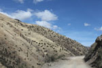 Terrain on road to Cuzco Terrain on road to Cuzco
(Peru)
-
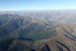
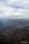
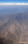
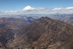
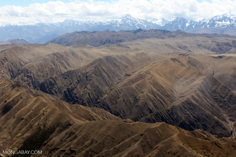
 Aerial view of the Andes Aerial view of the Andes
(Peru)
-
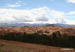
 Agricultural terraces and rice fields in valley near the Willoq community Agricultural terraces and rice fields in valley near the Willoq community
(Peru)
-
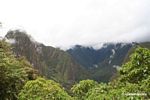
 Andes mountains near Machu Picchu Andes mountains near Machu Picchu
(Peru)
-
 Upper Amazon forest and the Andes Upper Amazon forest and the Andes
(Peru)
-
 Remote house atop a mountain peak in the Andes Remote house atop a mountain peak in the Andes
(Peru)
-
 Willoq boys Willoq boys
(Peru)
-
 Andean peaks Andean peaks
(Peru)
-
 Upper Amazon cloud forest and the Andes Upper Amazon cloud forest and the Andes
(Peru)
-
 Glacial peaks in the Andes Glacial peaks in the Andes
(Peru)
-
 Tree-line of the Amazon rainforest Tree-line of the Amazon rainforest
(Peru)
-
 Upper Amazon forest and the Andes Upper Amazon forest and the Andes
(Peru)
-
 Rugged Andes Rugged Andes
(Peru)
-
 Amazon cloud forest and the Andes Amazon cloud forest and the Andes
(Peru)
-
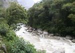
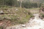
 Creek in Machu Picchu Pueblo Creek in Machu Picchu Pueblo
(Peru)
-
 Snow-capped mountains in the Andes Snow-capped mountains in the Andes
(Peru)
-
 Leaf-cutter ant nest Leaf-cutter ant nest
(Peru)
-
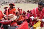 Distributing bread to kids in the Willoq community Distributing bread to kids in the Willoq community
(Peru)
-
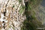
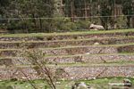
 Terraces in Valley of Willoq community Terraces in Valley of Willoq community
(Peru)
-
 Snow-capped mountains in the Andes with agricultural fields in the foreground Snow-capped mountains in the Andes with agricultural fields in the foreground
(Peru)
-
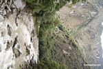
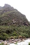
 Rock face covered with bromeliads Rock face covered with bromeliads
(Peru)
-
 Mountain peak in the Andes Mountain peak in the Andes
(Peru)
-
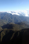
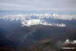
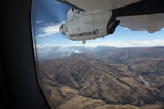
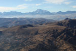
 Andes as seen from an airplane Andes as seen from an airplane
(Peru)
-
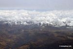 Snow-capped peaks in the Peruvian Andes Snow-capped peaks in the Peruvian Andes
(Peru)
-
 Glaciers in the Andes, as seen from an airplane Glaciers in the Andes, as seen from an airplane
(Peru)
-
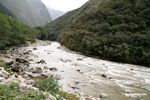
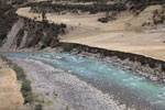
 Urubamba river near Machu Picchu Pueblo Urubamba river near Machu Picchu Pueblo
(Peru)
-
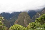
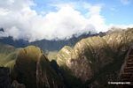
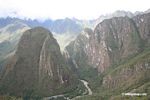 Mountains around Machu Picchu Mountains around Machu Picchu
(Peru)
-
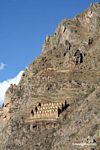
 Aerial view of terraces in the Andes Aerial view of terraces in the Andes
(Peru)
-
![Amazon cloud forest and the Andes [peru_aerial_0050]](http://s3.amazonaws.com/mongabay/peru/150/peru_aerial_0050.jpg) Amazon cloud forest and the Andes [peru_aerial_0050] Amazon cloud forest and the Andes [peru_aerial_0050]
(Peru)
-
 Treeline in the Andes Treeline in the Andes
(Peru)
-
 Highest reaches of the Amazon rainforest Highest reaches of the Amazon rainforest
(Peru)
-
 Andes Andes
(Peru)
-
 Andes Andes
(Peru)
-
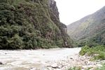
 Urubamba river Urubamba river
(Peru)
-
 Remote house atop a mountain peak in the Andes Remote house atop a mountain peak in the Andes
(Peru)
-
 Aerial view of the Andes Aerial view of the Andes
(Peru)
-
 Willoq child Willoq child
(Peru)
-
 Aerial view of the Andes Aerial view of the Andes
(Peru)
-
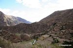 Agricultural terraces near the Willoq community Agricultural terraces near the Willoq community
(Peru)
-
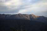
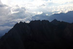
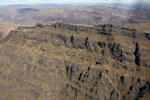 Steep mountain ridge in the Andes Steep mountain ridge in the Andes
(Peru)
-
 Snow-capped peaks in the Andes Snow-capped peaks in the Andes
(Peru)
-
 Snow-capped peaks in the Andes Snow-capped peaks in the Andes
(Peru)
-
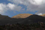
 High Andean grassland High Andean grassland
(Peru)
-
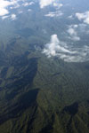
 Highland forest in the Amazon Highland forest in the Amazon
(Peru)
-
![Urubamba Valley [cuzco-Urubamba_1018_0613]](http://www.mongabay.com/thumbnails/peru/cuzco/Urubamba_1018_0613.JPG) Urubamba Valley [cuzco-Urubamba_1018_0613] Urubamba Valley [cuzco-Urubamba_1018_0613]
(Peru)
-
 Snow-capped peaks in the Andes Snow-capped peaks in the Andes
(Peru)
-
 Peruvian glaciers near the Urubamba valley Peruvian glaciers near the Urubamba valley
(Peru)
-
 Mountains around Machu Picchu Mountains around Machu Picchu
(Peru)
-
 Mountains around Machu Picchu Mountains around Machu Picchu
(Peru)
-
 The Andes as seen from an airplane The Andes as seen from an airplane
(Peru)
-
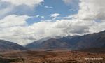
 Urubamba Valley Urubamba Valley
(Peru)
-
 Snow-capped mountains in the Andes Snow-capped mountains in the Andes
(Peru)
-
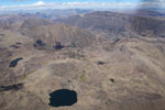
 Lake in the Andes Lake in the Andes
(Peru)
-
 Snow-capped peaks in the Andes Snow-capped peaks in the Andes
(Peru)
-
 Snow-capped mountains in the Andes Snow-capped mountains in the Andes
(Peru)
-
![Glacial peaks in the Andes [peru_aerial_1740]](http://s3.amazonaws.com/mongabay/peru/150/peru_aerial_1740.jpg) Glacial peaks in the Andes [peru_aerial_1740] Glacial peaks in the Andes [peru_aerial_1740]
(Peru)
-
![Urubamba Valley [cuzco-Urubamba_1018_0618]](http://www.mongabay.com/thumbnails/peru/cuzco/Urubamba_1018_0618.JPG) Urubamba Valley [cuzco-Urubamba_1018_0618] Urubamba Valley [cuzco-Urubamba_1018_0618]
(Peru)
-
 Mountain outside of Cuzco Mountain outside of Cuzco
(Peru)
-
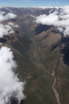
 Upper reaches of the Amazon rainforest in the Andes Upper reaches of the Amazon rainforest in the Andes
(Peru)
-
 Upper Amazon cloud forest and the Andes Upper Amazon cloud forest and the Andes
(Peru)
-
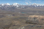
 Andean farmlands with snow-capped peaks in background Andean farmlands with snow-capped peaks in background
(Peru)
-
 Potato patches as seen from an airplane Potato patches as seen from an airplane
(Peru)
-
 Andean farmland Andean farmland
(Peru)
-
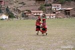 Children playing in the Willoq community Children playing in the Willoq community
(Peru)
-
 Urubamba Valley Urubamba Valley
(Peru)
-
 Terraces along the Urubamba river Terraces along the Urubamba river
(Peru)
-
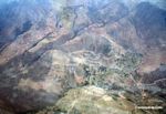
 Andean city viewed from above Andean city viewed from above
(Peru)
-
![Andean peaks and a turquoise lake [peru_aerial_1730]](http://s3.amazonaws.com/mongabay/peru/150/peru_aerial_1730.jpg) Andean peaks and a turquoise lake [peru_aerial_1730] Andean peaks and a turquoise lake [peru_aerial_1730]
(Peru)
-
![Upper Amazon forest and the Andes [peru_aerial_0095]](http://s3.amazonaws.com/mongabay/peru/150/peru_aerial_0095.jpg) Upper Amazon forest and the Andes [peru_aerial_0095] Upper Amazon forest and the Andes [peru_aerial_0095]
(Peru)
-
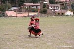
 Two children running Two children running
(Peru)
-
 Site of mudslide that covered the train tracks to Machu Picchu Site of mudslide that covered the train tracks to Machu Picchu
(Peru)
-
 Road to Wayqecha and Manu seen from an airplane Road to Wayqecha and Manu seen from an airplane
(Peru)
-
![Andes mountains in Peru [aerial-andes-Aerial_1026_3156]](http://www.mongabay.com/thumbnails/peru/aerial-andes/Aerial_1026_3156.JPG) Andes mountains in Peru [aerial-andes-Aerial_1026_3156] Andes mountains in Peru [aerial-andes-Aerial_1026_3156]
(Peru)
-
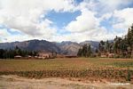
 Andean valley agriculture Andean valley agriculture
(Peru)
-
 Glaciers in the Andes, as seen from an airplane Glaciers in the Andes, as seen from an airplane
(Peru)
-
 Andes Andes
(Peru)
-
 Andean terrain Andean terrain
(Peru)
-
![Amazon rainforest and Andean glaciers and peaks [peru_aerial_0037]](http://s3.amazonaws.com/mongabay/peru/150/peru_aerial_0037.jpg) Amazon rainforest and Andean glaciers and peaks [peru_aerial_0037] Amazon rainforest and Andean glaciers and peaks [peru_aerial_0037]
(Peru)
-
 Red blooming trees along the Urubamba river Red blooming trees along the Urubamba river
(Peru)
-
![Amazon cloud forest and the Andes [peru_aerial_0049]](http://s3.amazonaws.com/mongabay/peru/150/peru_aerial_0049.jpg) Amazon cloud forest and the Andes [peru_aerial_0049] Amazon cloud forest and the Andes [peru_aerial_0049]
(Peru)
-
 Highest reaches of the Amazon rainforest Highest reaches of the Amazon rainforest
(Peru)
-
![Amazon cloud forest and the Andes [peru_aerial_0042]](http://s3.amazonaws.com/mongabay/peru/150/peru_aerial_0042.jpg) Amazon cloud forest and the Andes [peru_aerial_0042] Amazon cloud forest and the Andes [peru_aerial_0042]
(Peru)
-
 Amazon rain forest meeting the Andes Amazon rain forest meeting the Andes
(Peru)
-
 Andes as seen from an airplane Andes as seen from an airplane
(Peru)
-
![Amazon cloud forest and the Andes [peru_aerial_0047]](http://s3.amazonaws.com/mongabay/peru/150/peru_aerial_0047.jpg) Amazon cloud forest and the Andes [peru_aerial_0047] Amazon cloud forest and the Andes [peru_aerial_0047]
(Peru)
-
 Urubamba Valley Urubamba Valley
(Peru)
-
 Fernando and Willoq guide Fernando and Willoq guide
(Peru)
-
![Agricultural fire in the high Andes [peru_aerial_1750]](http://s3.amazonaws.com/mongabay/peru/150/peru_aerial_1750.jpg) Agricultural fire in the high Andes [peru_aerial_1750] Agricultural fire in the high Andes [peru_aerial_1750]
(Peru)
-
 Andean peak Andean peak
(Peru)
-
 Glaciers in the Andes, as seen from an aircraft Glaciers in the Andes, as seen from an aircraft
(Peru)
-
 High mountain forest near the tree-line in the Amazon Basin High mountain forest near the tree-line in the Amazon Basin
(Peru)
-
![Amazon cloud forest and the Andes [peru_aerial_0053]](http://s3.amazonaws.com/mongabay/peru/150/peru_aerial_0053.jpg) Amazon cloud forest and the Andes [peru_aerial_0053] Amazon cloud forest and the Andes [peru_aerial_0053]
(Peru)
-
 Glaciers in the Andes, as seen from an airplane Glaciers in the Andes, as seen from an airplane
(Peru)
-
![Highest reaches of the Amazon rainforest [peru_aerial_0062]](http://s3.amazonaws.com/mongabay/peru/150/peru_aerial_0062.jpg) Highest reaches of the Amazon rainforest [peru_aerial_0062] Highest reaches of the Amazon rainforest [peru_aerial_0062]
(Peru)
-
![Glacial peaks in the Andes [peru_aerial_0825]](http://s3.amazonaws.com/mongabay/peru/150/peru_aerial_0825.jpg) Glacial peaks in the Andes [peru_aerial_0825] Glacial peaks in the Andes [peru_aerial_0825]
(Peru)
-
![Andean city viewed from above [aerial-andes-Aerial_1030_5199]](http://www.mongabay.com/thumbnails/peru/aerial-andes/Aerial_1030_5199.JPG) Andean city viewed from above [aerial-andes-Aerial_1030_5199] Andean city viewed from above [aerial-andes-Aerial_1030_5199]
(Peru)
-
 Amazon cloud forest and the Andes Amazon cloud forest and the Andes
(Peru)
-
 Ice-covered mountains in Peru Ice-covered mountains in Peru
(Peru)
-
 Andean peak above the Amazon rainforest Andean peak above the Amazon rainforest
(Peru)
-
 Andean lake Andean lake
(Peru)
-
![Agricultural fire in the high Andes [peru_aerial_1748]](http://s3.amazonaws.com/mongabay/peru/150/peru_aerial_1748.jpg) Agricultural fire in the high Andes [peru_aerial_1748] Agricultural fire in the high Andes [peru_aerial_1748]
(Peru)
-
![Amazon cloud forest and the Andes [peru_aerial_0039]](http://s3.amazonaws.com/mongabay/peru/150/peru_aerial_0039.jpg) Amazon cloud forest and the Andes [peru_aerial_0039] Amazon cloud forest and the Andes [peru_aerial_0039]
(Peru)
-
![Steep mountain ridge near Cuzco [peru_aerial_1755]](http://s3.amazonaws.com/mongabay/peru/150/peru_aerial_1755.jpg) Steep mountain ridge near Cuzco [peru_aerial_1755] Steep mountain ridge near Cuzco [peru_aerial_1755]
(Peru)
-
![Snow-capped mountains in the Andes [cuzco-Urubamba_1018_0562]](http://www.mongabay.com/thumbnails/peru/cuzco/Urubamba_1018_0562.JPG) Snow-capped mountains in the Andes [cuzco-Urubamba_1018_0562] Snow-capped mountains in the Andes [cuzco-Urubamba_1018_0562]
(Peru)
-
 Upper Amazon forest and the Andes Upper Amazon forest and the Andes
(Peru)
-
 Snow-capped peaks in the Andes Snow-capped peaks in the Andes
(Peru)
-
 Andean river as seen from an airplane Andean river as seen from an airplane
(Peru)
-
![Road to Wayqecha and Manu seen from an airplane [peru_aerial_0067]](http://s3.amazonaws.com/mongabay/peru/150/peru_aerial_0067.jpg) Road to Wayqecha and Manu seen from an airplane [peru_aerial_0067] Road to Wayqecha and Manu seen from an airplane [peru_aerial_0067]
(Peru)
-
![Lake in the Andes [peru_aerial_1762]](http://s3.amazonaws.com/mongabay/peru/150/peru_aerial_1762.jpg) Lake in the Andes [peru_aerial_1762] Lake in the Andes [peru_aerial_1762]
(Peru)
-
![Snow-capped mountains in the Andes [cuzco-Urubamba_1018_0575]](http://www.mongabay.com/thumbnails/peru/cuzco/Urubamba_1018_0575.JPG) Snow-capped mountains in the Andes [cuzco-Urubamba_1018_0575] Snow-capped mountains in the Andes [cuzco-Urubamba_1018_0575]
(Peru)
-
![Amazon cloud forest and the Andes [peru_aerial_0040]](http://s3.amazonaws.com/mongabay/peru/150/peru_aerial_0040.jpg) Amazon cloud forest and the Andes [peru_aerial_0040] Amazon cloud forest and the Andes [peru_aerial_0040]
(Peru)
-
 Andes mountains near Machu Picchu Andes mountains near Machu Picchu
(Peru)
-
 Upper Amazon cloud forest and the Andes Upper Amazon cloud forest and the Andes
(Peru)
-
![Andes mountains in Peru [aerial-andes-Aerial_1026_3168]](http://www.mongabay.com/thumbnails/peru/aerial-andes/Aerial_1026_3168.JPG) Andes mountains in Peru [aerial-andes-Aerial_1026_3168] Andes mountains in Peru [aerial-andes-Aerial_1026_3168]
(Peru)
-
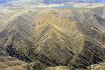
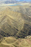
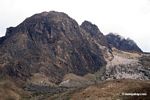
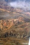
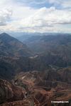
 Geological formations in the Andes mountains in Peru Geological formations in the Andes mountains in Peru
(Peru)
-
![Upper Amazon forest and the Andes [peru_aerial_0076]](http://s3.amazonaws.com/mongabay/peru/150/peru_aerial_0076.jpg) Upper Amazon forest and the Andes [peru_aerial_0076] Upper Amazon forest and the Andes [peru_aerial_0076]
(Peru)
-
![Andes mountains in Peru [aerial-andes-Aerial_1026_3172a]](http://www.mongabay.com/thumbnails/peru/aerial-andes/Aerial_1026_3172a.jpg) Andes mountains in Peru [aerial-andes-Aerial_1026_3172a] Andes mountains in Peru [aerial-andes-Aerial_1026_3172a]
(Peru)
-
 Bridge over Urubamba river Bridge over Urubamba river
(Peru)
-
 Mountains around Machu Picchu Mountains around Machu Picchu
(Peru)
-
![Amazon cloud forest and the Andes [peru_aerial_0045]](http://s3.amazonaws.com/mongabay/peru/150/peru_aerial_0045.jpg) Amazon cloud forest and the Andes [peru_aerial_0045] Amazon cloud forest and the Andes [peru_aerial_0045]
(Peru)
-
![Geological formations in the Andes mountains in Peru [aerial-andes-Aerial_1030_5191]](http://www.mongabay.com/thumbnails/peru/aerial-andes/Aerial_1030_5191.JPG) Geological formations in the Andes mountains in Peru [aerial-andes-Aerial_1030_5191] Geological formations in the Andes mountains in Peru [aerial-andes-Aerial_1030_5191]
(Peru)
-
 Aerial view of the Andes Aerial view of the Andes
(Peru)
-
 Andean peak Andean peak
(Peru)
-
![Road to Wayqecha and Manu seen from an airplane [peru_aerial_0065]](http://s3.amazonaws.com/mongabay/peru/150/peru_aerial_0065.jpg) Road to Wayqecha and Manu seen from an airplane [peru_aerial_0065] Road to Wayqecha and Manu seen from an airplane [peru_aerial_0065]
(Peru)
-
![Andes mountains in Peru [aerial-andes-Aerial_1024_3129]](http://www.mongabay.com/thumbnails/peru/aerial-andes/Aerial_1024_3129.JPG) Andes mountains in Peru [aerial-andes-Aerial_1024_3129] Andes mountains in Peru [aerial-andes-Aerial_1024_3129]
(Peru)
-
![Andean valley [peru_aerial_0813]](http://s3.amazonaws.com/mongabay/peru/150/peru_aerial_0813.jpg) Andean valley [peru_aerial_0813] Andean valley [peru_aerial_0813]
(Peru)
-
 Snow-capped mountains in the Andes Snow-capped mountains in the Andes
(Peru)
-
![Urubamba Valley [cuzco-Urubamba_1018_0720]](http://www.mongabay.com/thumbnails/peru/cuzco/Urubamba_1018_0720.JPG) Urubamba Valley [cuzco-Urubamba_1018_0720] Urubamba Valley [cuzco-Urubamba_1018_0720]
(Peru)
-
![Amazon cloud forest and the Andes [peru_aerial_0041]](http://s3.amazonaws.com/mongabay/peru/150/peru_aerial_0041.jpg) Amazon cloud forest and the Andes [peru_aerial_0041] Amazon cloud forest and the Andes [peru_aerial_0041]
(Peru)
-
![Andean peaks and a turquoise lake [peru_aerial_1732]](http://s3.amazonaws.com/mongabay/peru/150/peru_aerial_1732.jpg) Andean peaks and a turquoise lake [peru_aerial_1732] Andean peaks and a turquoise lake [peru_aerial_1732]
(Peru)
-
 Andes Andes
(Peru)
-
![High mountain forest near the tree-line in the Amazon Basin [peru_aerial_0103]](http://s3.amazonaws.com/mongabay/peru/150/peru_aerial_0103.jpg) High mountain forest near the tree-line in the Amazon Basin [peru_aerial_0103] High mountain forest near the tree-line in the Amazon Basin [peru_aerial_0103]
(Peru)
-
 Where the Amazon meets the Andes Where the Amazon meets the Andes
(Peru)
-
 Upper reaches of the Amazon rainforest in the Andes Upper reaches of the Amazon rainforest in the Andes
(Peru)
-
 Aerial view of the road to Manu Aerial view of the road to Manu
(Peru)
-
![Amazon cloud forest and the Andes [peru_aerial_0043]](http://s3.amazonaws.com/mongabay/peru/150/peru_aerial_0043.jpg) Amazon cloud forest and the Andes [peru_aerial_0043] Amazon cloud forest and the Andes [peru_aerial_0043]
(Peru)
-
 Andes Andes
(Peru)
-
 Andes mountains in Peru Andes mountains in Peru
(Peru)
-
 Distributing bread to the Willoq community Distributing bread to the Willoq community
(Peru)
-
 Snow-capped peaks in the Andes Snow-capped peaks in the Andes
(Peru)
-
![Snow-capped mountains in the Andes [cuzco-Urubamba_1018_0556]](http://www.mongabay.com/thumbnails/peru/cuzco/Urubamba_1018_0556.JPG) Snow-capped mountains in the Andes [cuzco-Urubamba_1018_0556] Snow-capped mountains in the Andes [cuzco-Urubamba_1018_0556]
(Peru)
-
![Steep mountain ridge near Cuzco [peru_aerial_1756]](http://s3.amazonaws.com/mongabay/peru/150/peru_aerial_1756.jpg) Steep mountain ridge near Cuzco [peru_aerial_1756] Steep mountain ridge near Cuzco [peru_aerial_1756]
(Peru)
-
![Upper Amazon forest and the Andes [peru_aerial_0094]](http://s3.amazonaws.com/mongabay/peru/150/peru_aerial_0094.jpg) Upper Amazon forest and the Andes [peru_aerial_0094] Upper Amazon forest and the Andes [peru_aerial_0094]
(Peru)
-
 Glaciers in the Andes, as seen from a plane Glaciers in the Andes, as seen from a plane
(Peru)
-
 Andes in Peru Andes in Peru
(Peru)
-
 Steep mountain ridge near Cuzco Steep mountain ridge near Cuzco
(Peru)
-
![High mountain forest near the tree-line in the Amazon Basin [peru_aerial_0105]](http://s3.amazonaws.com/mongabay/peru/150/peru_aerial_0105.jpg) High mountain forest near the tree-line in the Amazon Basin [peru_aerial_0105] High mountain forest near the tree-line in the Amazon Basin [peru_aerial_0105]
(Peru)
-
![Urubamba Valley [cuzco-Urubamba_1018_0732]](http://www.mongabay.com/thumbnails/peru/cuzco/Urubamba_1018_0732.JPG) Urubamba Valley [cuzco-Urubamba_1018_0732] Urubamba Valley [cuzco-Urubamba_1018_0732]
(Peru)
-
 Glaciers in the Andes, as seen from a plane Glaciers in the Andes, as seen from a plane
(Peru)
-
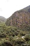
 Steep mountain ridge in the Andes Steep mountain ridge in the Andes
(Peru)
-
 Glacial river in the Andes Glacial river in the Andes
(Peru)
-
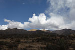
 Agricultural fire in the high Andes Agricultural fire in the high Andes
(Peru)
-
 Aerial view of the Andes Aerial view of the Andes
(Peru)
-
 Andes mountains in Peru Andes mountains in Peru
(Peru)
-
 Road to Manu seen from an airplane Road to Manu seen from an airplane
(Peru)
-
 Aerial view of the Andes Aerial view of the Andes
(Peru)
-
![Andes mountains in Peru [aerial-andes-Aerial_1024_3128]](http://www.mongabay.com/thumbnails/peru/aerial-andes/Aerial_1024_3128.JPG) Andes mountains in Peru [aerial-andes-Aerial_1024_3128] Andes mountains in Peru [aerial-andes-Aerial_1024_3128]
(Peru)
-
 Andes mountains in Peru Andes mountains in Peru
(Peru)
-
 Red flowered trees along Urubamba river Red flowered trees along Urubamba river
(Peru)
-
![High mountain forest near the tree-line in the Amazon Basin [peru_aerial_0100]](http://s3.amazonaws.com/mongabay/peru/150/peru_aerial_0100.jpg) High mountain forest near the tree-line in the Amazon Basin [peru_aerial_0100] High mountain forest near the tree-line in the Amazon Basin [peru_aerial_0100]
(Peru)
-
 Andean peaks and a turquoise lake Andean peaks and a turquoise lake
(Peru)
-
![Upper Amazon forest and the Andes [peru_aerial_0089]](http://s3.amazonaws.com/mongabay/peru/150/peru_aerial_0089.jpg) Upper Amazon forest and the Andes [peru_aerial_0089] Upper Amazon forest and the Andes [peru_aerial_0089]
(Peru)
-
![Andes as seen from an airplane [peru_aerial_0816]](http://s3.amazonaws.com/mongabay/peru/150/peru_aerial_0816.jpg) Andes as seen from an airplane [peru_aerial_0816] Andes as seen from an airplane [peru_aerial_0816]
(Peru)
-
![Upper Amazon cloud forest and the Andes [peru_aerial_0110]](http://s3.amazonaws.com/mongabay/peru/150/peru_aerial_0110.jpg) Upper Amazon cloud forest and the Andes [peru_aerial_0110] Upper Amazon cloud forest and the Andes [peru_aerial_0110]
(Peru)
-
 The Andes as seen from an airplane The Andes as seen from an airplane
(Peru)
-
 Agricultural fire in Andes Agricultural fire in Andes
(Peru)
-
 Upper Amazon forest and the Andes Upper Amazon forest and the Andes
(Peru)
-
![Road to Wayqecha and Manu seen from an airplane [peru_aerial_0066]](http://s3.amazonaws.com/mongabay/peru/150/peru_aerial_0066.jpg) Road to Wayqecha and Manu seen from an airplane [peru_aerial_0066] Road to Wayqecha and Manu seen from an airplane [peru_aerial_0066]
(Peru)
-
![Aerial view of the road to Manu [peru_aerial_0078]](http://s3.amazonaws.com/mongabay/peru/150/peru_aerial_0078.jpg) Aerial view of the road to Manu [peru_aerial_0078] Aerial view of the road to Manu [peru_aerial_0078]
(Peru)
-
 Glacier-covered mountains in the Andes Glacier-covered mountains in the Andes
(Peru)
-
![Aerial view of the road to Manu [peru_aerial_0079]](http://s3.amazonaws.com/mongabay/peru/150/peru_aerial_0079.jpg) Aerial view of the road to Manu [peru_aerial_0079] Aerial view of the road to Manu [peru_aerial_0079]
(Peru)
-
 Lake in the Andes Lake in the Andes
(Peru)
-
 Andes near Lima Andes near Lima
(Peru)
-
 Andean road Andean road
(Peru)
-
![Agricultural fire in Andes [aerial-andes-Aerial_1030_5211]](http://www.mongabay.com/thumbnails/peru/aerial-andes/Aerial_1030_5211.JPG) Agricultural fire in Andes [aerial-andes-Aerial_1030_5211] Agricultural fire in Andes [aerial-andes-Aerial_1030_5211]
(Peru)
-
![Andes mountains in Peru [aerial-andes-Aerial_1026_3160]](http://www.mongabay.com/thumbnails/peru/aerial-andes/Aerial_1026_3160.JPG) Andes mountains in Peru [aerial-andes-Aerial_1026_3160] Andes mountains in Peru [aerial-andes-Aerial_1026_3160]
(Peru)
-
 Glacial peaks in the Andes Glacial peaks in the Andes
(Peru)
-
![Andes in Peru [peru_aerial_1746]](http://s3.amazonaws.com/mongabay/peru/150/peru_aerial_1746.jpg) Andes in Peru [peru_aerial_1746] Andes in Peru [peru_aerial_1746]
(Peru)
-
 Urubamba river near Machu Picchu Pueblo Urubamba river near Machu Picchu Pueblo
(Peru)
-
 Adobe house in the Andes Adobe house in the Andes
(Peru)
-
 Snow-capped peaks in the Andes Snow-capped peaks in the Andes
(Peru)
-
 Andean mountain ridge Andean mountain ridge
(Peru)
-
 Site of mudslide that covered the railroad tracks to Machu Picchu Site of mudslide that covered the railroad tracks to Machu Picchu
(Peru)
-
![Upper Amazon forest and the Andes [peru_aerial_0091]](http://s3.amazonaws.com/mongabay/peru/150/peru_aerial_0091.jpg) Upper Amazon forest and the Andes [peru_aerial_0091] Upper Amazon forest and the Andes [peru_aerial_0091]
(Peru)
-
![Upper Amazon cloud forest and the Andes [peru_aerial_0112]](http://s3.amazonaws.com/mongabay/peru/150/peru_aerial_0112.jpg) Upper Amazon cloud forest and the Andes [peru_aerial_0112] Upper Amazon cloud forest and the Andes [peru_aerial_0112]
(Peru)
-
![Andean river as seen from an airplane [peru_aerial_0810]](http://s3.amazonaws.com/mongabay/peru/150/peru_aerial_0810.jpg) Andean river as seen from an airplane [peru_aerial_0810] Andean river as seen from an airplane [peru_aerial_0810]
(Peru)
-
![Andes mountains in Peru [aerial-andes-Aerial_1026_3167]](http://www.mongabay.com/thumbnails/peru/aerial-andes/Aerial_1026_3167.JPG) Andes mountains in Peru [aerial-andes-Aerial_1026_3167] Andes mountains in Peru [aerial-andes-Aerial_1026_3167]
(Peru)
-
![Andean peaks and a turquoise lake [peru_aerial_1735]](http://s3.amazonaws.com/mongabay/peru/150/peru_aerial_1735.jpg) Andean peaks and a turquoise lake [peru_aerial_1735] Andean peaks and a turquoise lake [peru_aerial_1735]
(Peru)
-
 Andean mountain peaks peeking through clouds Andean mountain peaks peeking through clouds
(Peru)
-
![Andean peaks and a turquoise lake [peru_aerial_1733]](http://s3.amazonaws.com/mongabay/peru/150/peru_aerial_1733.jpg) Andean peaks and a turquoise lake [peru_aerial_1733] Andean peaks and a turquoise lake [peru_aerial_1733]
(Peru)
-
 Glaciers in the Andes, as seen from an aircraft Glaciers in the Andes, as seen from an aircraft
(Peru)
-
![Andean peaks and a turquoise lake [peru_aerial_1744]](http://s3.amazonaws.com/mongabay/peru/150/peru_aerial_1744.jpg) Andean peaks and a turquoise lake [peru_aerial_1744] Andean peaks and a turquoise lake [peru_aerial_1744]
(Peru)
-
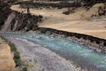
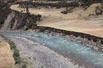
 Turquoise river in the Andes Turquoise river in the Andes
(Peru)
-
![Amazon cloud forest and the Andes [peru_aerial_0055]](http://s3.amazonaws.com/mongabay/peru/150/peru_aerial_0055.jpg) Amazon cloud forest and the Andes [peru_aerial_0055] Amazon cloud forest and the Andes [peru_aerial_0055]
(Peru)
-
![Highest reaches of the Amazon rainforest [peru_aerial_0061]](http://s3.amazonaws.com/mongabay/peru/150/peru_aerial_0061.jpg) Highest reaches of the Amazon rainforest [peru_aerial_0061] Highest reaches of the Amazon rainforest [peru_aerial_0061]
(Peru)
-
 Amazon rainforest and Andean glaciers and peaks Amazon rainforest and Andean glaciers and peaks
(Peru)
-
 Andean lake as seen from an airplane Andean lake as seen from an airplane
(Peru)
-
 Glaciers in the Andes, as seen from an airplane Glaciers in the Andes, as seen from an airplane
(Peru)
-
 Site of mudslide that covered the railroad tracks to Machu Picchu Site of mudslide that covered the railroad tracks to Machu Picchu
(Peru)
-
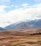
 Andean valley Andean valley
(Peru)
-
 Two girls running Two girls running
(Peru)
-
![Andean peaks [peru_aerial_1728]](http://s3.amazonaws.com/mongabay/peru/150/peru_aerial_1728.jpg) Andean peaks [peru_aerial_1728] Andean peaks [peru_aerial_1728]
(Peru)
-
![Remote house atop a mountain peak in the Andes [peru_aerial_1721]](http://s3.amazonaws.com/mongabay/peru/150/peru_aerial_1721.jpg) Remote house atop a mountain peak in the Andes [peru_aerial_1721] Remote house atop a mountain peak in the Andes [peru_aerial_1721]
(Peru)
-
 Upper Amazon forest and the Andes Upper Amazon forest and the Andes
(Peru)
-
 Glaciers in the Andes, as seen from a plane Glaciers in the Andes, as seen from a plane
(Peru)
-
![Remote house atop a mountain peak in the Andes [peru_aerial_1723]](http://s3.amazonaws.com/mongabay/peru/150/peru_aerial_1723.jpg) Remote house atop a mountain peak in the Andes [peru_aerial_1723] Remote house atop a mountain peak in the Andes [peru_aerial_1723]
(Peru)
-
 Urubamba river valley; high rock faces Urubamba river valley; high rock faces
(Peru)
-
 Andean peaks and a turquoise lake Andean peaks and a turquoise lake
(Peru)
-
![Road to Wayqecha and Manu seen from an airplane [peru_aerial_0070]](http://s3.amazonaws.com/mongabay/peru/150/peru_aerial_0070.jpg) Road to Wayqecha and Manu seen from an airplane [peru_aerial_0070] Road to Wayqecha and Manu seen from an airplane [peru_aerial_0070]
(Peru)
-
![Glacial peaks in the Andes [peru_aerial_1738]](http://s3.amazonaws.com/mongabay/peru/150/peru_aerial_1738.jpg) Glacial peaks in the Andes [peru_aerial_1738] Glacial peaks in the Andes [peru_aerial_1738]
(Peru)
-
![Lake in the Andes [peru_aerial_1763]](http://s3.amazonaws.com/mongabay/peru/150/peru_aerial_1763.jpg) Lake in the Andes [peru_aerial_1763] Lake in the Andes [peru_aerial_1763]
(Peru)
-
 Aerial view of Urubamba valley in distance Aerial view of Urubamba valley in distance
(Peru)
-
![High mountain forest near the tree-line in the Amazon Basin [peru_aerial_0102]](http://s3.amazonaws.com/mongabay/peru/150/peru_aerial_0102.jpg) High mountain forest near the tree-line in the Amazon Basin [peru_aerial_0102] High mountain forest near the tree-line in the Amazon Basin [peru_aerial_0102]
(Peru)
-
![Urubamba Valley [cuzco-Urubamba_1018_0734]](http://www.mongabay.com/thumbnails/peru/cuzco/Urubamba_1018_0734.JPG) Urubamba Valley [cuzco-Urubamba_1018_0734] Urubamba Valley [cuzco-Urubamba_1018_0734]
(Peru)
-
 Remote house atop a mountain peak in the Andes Remote house atop a mountain peak in the Andes
(Peru)
-
 Urubamba river Urubamba river
(Peru)
-
 Where the Amazon rainforest meets the Andes Where the Amazon rainforest meets the Andes
(Peru)
-
![Andes mountains in Peru [aerial-andes-Aerial_1026_3165]](http://www.mongabay.com/thumbnails/peru/aerial-andes/Aerial_1026_3165.JPG) Andes mountains in Peru [aerial-andes-Aerial_1026_3165] Andes mountains in Peru [aerial-andes-Aerial_1026_3165]
(Peru)
-
![Road to Wayqecha and Manu seen from an airplane [peru_aerial_0069]](http://s3.amazonaws.com/mongabay/peru/150/peru_aerial_0069.jpg) Road to Wayqecha and Manu seen from an airplane [peru_aerial_0069] Road to Wayqecha and Manu seen from an airplane [peru_aerial_0069]
(Peru)
-
 Glaciers in the Andes, as seen from an aircraft Glaciers in the Andes, as seen from an aircraft
(Peru)
-
![Road to Wayqecha and Manu seen from an airplane [peru_aerial_0068]](http://s3.amazonaws.com/mongabay/peru/150/peru_aerial_0068.jpg) Road to Wayqecha and Manu seen from an airplane [peru_aerial_0068] Road to Wayqecha and Manu seen from an airplane [peru_aerial_0068]
(Peru)
-
 Rugged terrain in western Peru Rugged terrain in western Peru
(Peru)
-
![Andean peaks and a turquoise lake [peru_aerial_1743]](http://s3.amazonaws.com/mongabay/peru/150/peru_aerial_1743.jpg) Andean peaks and a turquoise lake [peru_aerial_1743] Andean peaks and a turquoise lake [peru_aerial_1743]
(Peru)
-
![Andes mountains in Peru [aerial-andes-Aerial_1030_5202]](http://www.mongabay.com/thumbnails/peru/aerial-andes/Aerial_1030_5202.JPG) Andes mountains in Peru [aerial-andes-Aerial_1030_5202] Andes mountains in Peru [aerial-andes-Aerial_1030_5202]
(Peru)
-
![Upper Amazon forest and the Andes [peru_aerial_0092]](http://s3.amazonaws.com/mongabay/peru/150/peru_aerial_0092.jpg) Upper Amazon forest and the Andes [peru_aerial_0092] Upper Amazon forest and the Andes [peru_aerial_0092]
(Peru)
-
 Glacial peaks in the Andes Glacial peaks in the Andes
(Peru)
-
 Andean peaks Andean peaks
(Peru)
-
![Steep mountain ridge in the Andes [peru_aerial_1752]](http://s3.amazonaws.com/mongabay/peru/150/peru_aerial_1752.jpg) Steep mountain ridge in the Andes [peru_aerial_1752] Steep mountain ridge in the Andes [peru_aerial_1752]
(Peru)
-
![Amazon cloud forest and the Andes [peru_aerial_0057]](http://s3.amazonaws.com/mongabay/peru/150/peru_aerial_0057.jpg) Amazon cloud forest and the Andes [peru_aerial_0057] Amazon cloud forest and the Andes [peru_aerial_0057]
(Peru)
-
 Mountain known as Machu Picchu Mountain known as Machu Picchu
(Peru)
-
![Amazon rainforest and Andean glaciers and peaks [peru_aerial_0035]](http://s3.amazonaws.com/mongabay/peru/150/peru_aerial_0035.jpg) Amazon rainforest and Andean glaciers and peaks [peru_aerial_0035] Amazon rainforest and Andean glaciers and peaks [peru_aerial_0035]
(Peru)
-
 Aerial view of Cuzco Aerial view of Cuzco
(Peru)
-
![Remote house atop a mountain peak in the Andes [peru_aerial_1724]](http://s3.amazonaws.com/mongabay/peru/150/peru_aerial_1724.jpg) Remote house atop a mountain peak in the Andes [peru_aerial_1724] Remote house atop a mountain peak in the Andes [peru_aerial_1724]
(Peru)
-
 Glaciers in the Andes, as seen from an aircraft Glaciers in the Andes, as seen from an aircraft
(Peru)
-
![Amazon cloud forest and the Andes [peru_aerial_0051]](http://s3.amazonaws.com/mongabay/peru/150/peru_aerial_0051.jpg) Amazon cloud forest and the Andes [peru_aerial_0051] Amazon cloud forest and the Andes [peru_aerial_0051]
(Peru)
-
![Andes mountains in Peru [aerial-andes-Aerial_1026_3172]](http://www.mongabay.com/thumbnails/peru/aerial-andes/Aerial_1026_3172.JPG) Andes mountains in Peru [aerial-andes-Aerial_1026_3172] Andes mountains in Peru [aerial-andes-Aerial_1026_3172]
(Peru)
-
![Urubamba Valley [cuzco-Urubamba_1018_0646]](http://www.mongabay.com/thumbnails/peru/cuzco/Urubamba_1018_0646.JPG) Urubamba Valley [cuzco-Urubamba_1018_0646] Urubamba Valley [cuzco-Urubamba_1018_0646]
(Peru)
-
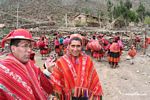
 Willoq community members; women and children Willoq community members; women and children
(Peru)
-
 Amazon tree-line Amazon tree-line
(Peru)
-
![Andean peak above the Amazon rainforest [peru_aerial_0860]](http://s3.amazonaws.com/mongabay/peru/150/peru_aerial_0860.jpg) Andean peak above the Amazon rainforest [peru_aerial_0860] Andean peak above the Amazon rainforest [peru_aerial_0860]
(Peru)
-
 Upper Amazon forest and the Andes Upper Amazon forest and the Andes
(Peru)
|


![Amazon cloud forest and the Andes [peru_aerial_0054]](http://mongabay-images.s3.amazonaws.com/780/peru/peru_aerial_0054.jpg)
![Remote house atop a mountain peak in the Andes [peru_aerial_1725]](http://mongabay-images.s3.amazonaws.com/780/peru/peru_aerial_1725.jpg)


![Urubamba Valley [cuzco-Urubamba_1018_0729]](http://mongabay-images.s3.amazonaws.com/780/peru/Urubamba_1018_0729.jpg)


![Urubamba Valley [cuzco-Urubamba_1018_0620]](http://mongabay-images.s3.amazonaws.com/780/peru/Urubamba_1018_0620.jpg)


![Urubamba Valley [cuzco-Urubamba_1018_0644]](http://mongabay-images.s3.amazonaws.com/780/peru/Urubamba_1018_0644.jpg)


![Amazon cloud forest and the Andes [peru_aerial_0048]](http://mongabay-images.s3.amazonaws.com/780/peru/peru_aerial_0048.jpg)


![Amazon cloud forest and the Andes [peru_aerial_0050]](http://mongabay-images.s3.amazonaws.com/780/peru/peru_aerial_0050.jpg)


![Urubamba Valley [cuzco-Urubamba_1018_0613]](http://mongabay-images.s3.amazonaws.com/780/peru/Urubamba_1018_0613.jpg)


![Glacial peaks in the Andes [peru_aerial_1740]](http://mongabay-images.s3.amazonaws.com/780/peru/peru_aerial_1740.jpg)
![Urubamba Valley [cuzco-Urubamba_1018_0618]](http://mongabay-images.s3.amazonaws.com/780/peru/Urubamba_1018_0618.jpg)


![Andean peaks and a turquoise lake [peru_aerial_1730]](http://mongabay-images.s3.amazonaws.com/780/peru/peru_aerial_1730.jpg)
![Upper Amazon forest and the Andes [peru_aerial_0095]](http://mongabay-images.s3.amazonaws.com/780/peru/peru_aerial_0095.jpg)


![Andes mountains in Peru [aerial-andes-Aerial_1026_3156]](http://mongabay-images.s3.amazonaws.com/780/peru/Aerial_1026_3156.jpg)


![Amazon rainforest and Andean glaciers and peaks [peru_aerial_0037]](http://mongabay-images.s3.amazonaws.com/780/peru/peru_aerial_0037.jpg)

![Amazon cloud forest and the Andes [peru_aerial_0049]](http://mongabay-images.s3.amazonaws.com/780/peru/peru_aerial_0049.jpg)

![Amazon cloud forest and the Andes [peru_aerial_0042]](http://mongabay-images.s3.amazonaws.com/780/peru/peru_aerial_0042.jpg)


![Amazon cloud forest and the Andes [peru_aerial_0047]](http://mongabay-images.s3.amazonaws.com/780/peru/peru_aerial_0047.jpg)


![Agricultural fire in the high Andes [peru_aerial_1750]](http://mongabay-images.s3.amazonaws.com/780/peru/peru_aerial_1750.jpg)


![Amazon cloud forest and the Andes [peru_aerial_0053]](http://mongabay-images.s3.amazonaws.com/780/peru/peru_aerial_0053.jpg)

![Highest reaches of the Amazon rainforest [peru_aerial_0062]](http://mongabay-images.s3.amazonaws.com/780/peru/peru_aerial_0062.jpg)
![Glacial peaks in the Andes [peru_aerial_0825]](http://mongabay-images.s3.amazonaws.com/780/peru/peru_aerial_0825.jpg)
![Andean city viewed from above [aerial-andes-Aerial_1030_5199]](http://mongabay-images.s3.amazonaws.com/780/peru/Aerial_1030_5199.jpg)


![Agricultural fire in the high Andes [peru_aerial_1748]](http://mongabay-images.s3.amazonaws.com/780/peru/peru_aerial_1748.jpg)
![Amazon cloud forest and the Andes [peru_aerial_0039]](http://mongabay-images.s3.amazonaws.com/780/peru/peru_aerial_0039.jpg)
![Steep mountain ridge near Cuzco [peru_aerial_1755]](http://mongabay-images.s3.amazonaws.com/780/peru/peru_aerial_1755.jpg)
![Snow-capped mountains in the Andes [cuzco-Urubamba_1018_0562]](http://mongabay-images.s3.amazonaws.com/780/peru/Urubamba_1018_0562.jpg)


![Road to Wayqecha and Manu seen from an airplane [peru_aerial_0067]](http://mongabay-images.s3.amazonaws.com/780/peru/peru_aerial_0067.jpg)
![Lake in the Andes [peru_aerial_1762]](http://mongabay-images.s3.amazonaws.com/780/peru/peru_aerial_1762.jpg)
![Snow-capped mountains in the Andes [cuzco-Urubamba_1018_0575]](http://mongabay-images.s3.amazonaws.com/780/peru/Urubamba_1018_0575.jpg)
![Amazon cloud forest and the Andes [peru_aerial_0040]](http://mongabay-images.s3.amazonaws.com/780/peru/peru_aerial_0040.jpg)


![Andes mountains in Peru [aerial-andes-Aerial_1026_3168]](http://mongabay-images.s3.amazonaws.com/780/peru/Aerial_1026_3168.jpg)

![Upper Amazon forest and the Andes [peru_aerial_0076]](http://mongabay-images.s3.amazonaws.com/780/peru/peru_aerial_0076.jpg)
![Andes mountains in Peru [aerial-andes-Aerial_1026_3172a]](http://mongabay-images.s3.amazonaws.com/780/peru/Aerial_1026_3172a.jpg)


![Amazon cloud forest and the Andes [peru_aerial_0045]](http://mongabay-images.s3.amazonaws.com/780/peru/peru_aerial_0045.jpg)
![Geological formations in the Andes mountains in Peru [aerial-andes-Aerial_1030_5191]](http://mongabay-images.s3.amazonaws.com/780/peru/Aerial_1030_5191.jpg)


![Road to Wayqecha and Manu seen from an airplane [peru_aerial_0065]](http://mongabay-images.s3.amazonaws.com/780/peru/peru_aerial_0065.jpg)
![Andes mountains in Peru [aerial-andes-Aerial_1024_3129]](http://mongabay-images.s3.amazonaws.com/780/peru/Aerial_1024_3129.jpg)
![Andean valley [peru_aerial_0813]](http://mongabay-images.s3.amazonaws.com/780/peru/peru_aerial_0813.jpg)

![Urubamba Valley [cuzco-Urubamba_1018_0720]](http://mongabay-images.s3.amazonaws.com/780/peru/Urubamba_1018_0720.jpg)
![Amazon cloud forest and the Andes [peru_aerial_0041]](http://mongabay-images.s3.amazonaws.com/780/peru/peru_aerial_0041.jpg)
![Andean peaks and a turquoise lake [peru_aerial_1732]](http://mongabay-images.s3.amazonaws.com/780/peru/peru_aerial_1732.jpg)

![High mountain forest near the tree-line in the Amazon Basin [peru_aerial_0103]](http://mongabay-images.s3.amazonaws.com/780/peru/peru_aerial_0103.jpg)


![Amazon cloud forest and the Andes [peru_aerial_0043]](http://mongabay-images.s3.amazonaws.com/780/peru/peru_aerial_0043.jpg)


![Snow-capped mountains in the Andes [cuzco-Urubamba_1018_0556]](http://mongabay-images.s3.amazonaws.com/780/peru/Urubamba_1018_0556.jpg)
![Steep mountain ridge near Cuzco [peru_aerial_1756]](http://mongabay-images.s3.amazonaws.com/780/peru/peru_aerial_1756.jpg)
![Upper Amazon forest and the Andes [peru_aerial_0094]](http://mongabay-images.s3.amazonaws.com/780/peru/peru_aerial_0094.jpg)


![High mountain forest near the tree-line in the Amazon Basin [peru_aerial_0105]](http://mongabay-images.s3.amazonaws.com/780/peru/peru_aerial_0105.jpg)
![Urubamba Valley [cuzco-Urubamba_1018_0732]](http://mongabay-images.s3.amazonaws.com/780/peru/Urubamba_1018_0732.jpg)


![Andes mountains in Peru [aerial-andes-Aerial_1024_3128]](http://mongabay-images.s3.amazonaws.com/780/peru/Aerial_1024_3128.jpg)


![High mountain forest near the tree-line in the Amazon Basin [peru_aerial_0100]](http://mongabay-images.s3.amazonaws.com/780/peru/peru_aerial_0100.jpg)

![Upper Amazon forest and the Andes [peru_aerial_0089]](http://mongabay-images.s3.amazonaws.com/780/peru/peru_aerial_0089.jpg)
![Andes as seen from an airplane [peru_aerial_0816]](http://mongabay-images.s3.amazonaws.com/780/peru/peru_aerial_0816.jpg)
![Upper Amazon cloud forest and the Andes [peru_aerial_0110]](http://mongabay-images.s3.amazonaws.com/780/peru/peru_aerial_0110.jpg)


![Road to Wayqecha and Manu seen from an airplane [peru_aerial_0066]](http://mongabay-images.s3.amazonaws.com/780/peru/peru_aerial_0066.jpg)
![Aerial view of the road to Manu [peru_aerial_0078]](http://mongabay-images.s3.amazonaws.com/780/peru/peru_aerial_0078.jpg)

![Aerial view of the road to Manu [peru_aerial_0079]](http://mongabay-images.s3.amazonaws.com/780/peru/peru_aerial_0079.jpg)


![Agricultural fire in Andes [aerial-andes-Aerial_1030_5211]](http://mongabay-images.s3.amazonaws.com/780/peru/Aerial_1030_5211.jpg)
![Andes mountains in Peru [aerial-andes-Aerial_1026_3160]](http://mongabay-images.s3.amazonaws.com/780/peru/Aerial_1026_3160.jpg)

![Andes in Peru [peru_aerial_1746]](http://mongabay-images.s3.amazonaws.com/780/peru/peru_aerial_1746.jpg)


![Upper Amazon forest and the Andes [peru_aerial_0091]](http://mongabay-images.s3.amazonaws.com/780/peru/peru_aerial_0091.jpg)
![Upper Amazon cloud forest and the Andes [peru_aerial_0112]](http://mongabay-images.s3.amazonaws.com/780/peru/peru_aerial_0112.jpg)
![Andean river as seen from an airplane [peru_aerial_0810]](http://mongabay-images.s3.amazonaws.com/780/peru/peru_aerial_0810.jpg)
![Andes mountains in Peru [aerial-andes-Aerial_1026_3167]](http://mongabay-images.s3.amazonaws.com/780/peru/Aerial_1026_3167.jpg)
![Andean peaks and a turquoise lake [peru_aerial_1735]](http://mongabay-images.s3.amazonaws.com/780/peru/peru_aerial_1735.jpg)

![Andean peaks and a turquoise lake [peru_aerial_1733]](http://mongabay-images.s3.amazonaws.com/780/peru/peru_aerial_1733.jpg)

![Andean peaks and a turquoise lake [peru_aerial_1744]](http://mongabay-images.s3.amazonaws.com/780/peru/peru_aerial_1744.jpg)

![Amazon cloud forest and the Andes [peru_aerial_0055]](http://mongabay-images.s3.amazonaws.com/780/peru/peru_aerial_0055.jpg)
![Highest reaches of the Amazon rainforest [peru_aerial_0061]](http://mongabay-images.s3.amazonaws.com/780/peru/peru_aerial_0061.jpg)


![Andean peaks [peru_aerial_1728]](http://mongabay-images.s3.amazonaws.com/780/peru/peru_aerial_1728.jpg)
![Remote house atop a mountain peak in the Andes [peru_aerial_1721]](http://mongabay-images.s3.amazonaws.com/780/peru/peru_aerial_1721.jpg)


![Remote house atop a mountain peak in the Andes [peru_aerial_1723]](http://mongabay-images.s3.amazonaws.com/780/peru/peru_aerial_1723.jpg)


![Road to Wayqecha and Manu seen from an airplane [peru_aerial_0070]](http://mongabay-images.s3.amazonaws.com/780/peru/peru_aerial_0070.jpg)
![Glacial peaks in the Andes [peru_aerial_1738]](http://mongabay-images.s3.amazonaws.com/780/peru/peru_aerial_1738.jpg)
![Lake in the Andes [peru_aerial_1763]](http://mongabay-images.s3.amazonaws.com/780/peru/peru_aerial_1763.jpg)

![High mountain forest near the tree-line in the Amazon Basin [peru_aerial_0102]](http://mongabay-images.s3.amazonaws.com/780/peru/peru_aerial_0102.jpg)
![Urubamba Valley [cuzco-Urubamba_1018_0734]](http://mongabay-images.s3.amazonaws.com/780/peru/Urubamba_1018_0734.jpg)


![Andes mountains in Peru [aerial-andes-Aerial_1026_3165]](http://mongabay-images.s3.amazonaws.com/780/peru/Aerial_1026_3165.jpg)
![Road to Wayqecha and Manu seen from an airplane [peru_aerial_0069]](http://mongabay-images.s3.amazonaws.com/780/peru/peru_aerial_0069.jpg)

![Road to Wayqecha and Manu seen from an airplane [peru_aerial_0068]](http://mongabay-images.s3.amazonaws.com/780/peru/peru_aerial_0068.jpg)

![Andean peaks and a turquoise lake [peru_aerial_1743]](http://mongabay-images.s3.amazonaws.com/780/peru/peru_aerial_1743.jpg)
![Andes mountains in Peru [aerial-andes-Aerial_1030_5202]](http://mongabay-images.s3.amazonaws.com/780/peru/Aerial_1030_5202.jpg)
![Upper Amazon forest and the Andes [peru_aerial_0092]](http://mongabay-images.s3.amazonaws.com/780/peru/peru_aerial_0092.jpg)


![Steep mountain ridge in the Andes [peru_aerial_1752]](http://mongabay-images.s3.amazonaws.com/780/peru/peru_aerial_1752.jpg)
![Amazon cloud forest and the Andes [peru_aerial_0057]](http://mongabay-images.s3.amazonaws.com/780/peru/peru_aerial_0057.jpg)

![Amazon rainforest and Andean glaciers and peaks [peru_aerial_0035]](http://mongabay-images.s3.amazonaws.com/780/peru/peru_aerial_0035.jpg)

![Remote house atop a mountain peak in the Andes [peru_aerial_1724]](http://mongabay-images.s3.amazonaws.com/780/peru/peru_aerial_1724.jpg)

![Amazon cloud forest and the Andes [peru_aerial_0051]](http://mongabay-images.s3.amazonaws.com/780/peru/peru_aerial_0051.jpg)
![Andes mountains in Peru [aerial-andes-Aerial_1026_3172]](http://mongabay-images.s3.amazonaws.com/780/peru/Aerial_1026_3172.jpg)
![Urubamba Valley [cuzco-Urubamba_1018_0646]](http://mongabay-images.s3.amazonaws.com/780/peru/Urubamba_1018_0646.jpg)


![Andean peak above the Amazon rainforest [peru_aerial_0860]](http://mongabay-images.s3.amazonaws.com/780/peru/peru_aerial_0860.jpg)
